
Location & Safety
Is Klang Prone to Flooding? Inside Setia Bayuemas' Flood Mitigation System
Klang has a flood history. Here's how Setia Bayuemas' drainage and Lake Park retention system is engineered to keep the township dry.
By Setia Bayuemas Editorial Team
Quick answer
Klang district has recorded flash flooding in specific low-lying neighbourhoods, and the wider "Klang Valley" region floods periodically after heavy rain. Setia Bayuemas itself, however, is not among the flood-prone zones mapped in the Klang Royal City Council's 2025 stormwater plan, and SP Setia states the township has had no flood disruptions since it began welcoming residents. The estate's engineered drainage network and 10-acre Lake Park are designed to hold and slow stormwater on-site, using the same detention-pond principle set out in Malaysia's official Urban Stormwater Management Manual (MSMA).
Key insights
- Klang town has recorded flash floods in specific low-lying kampung and taman areas, but Setia Bayuemas is not on the city council's 2025 list of mapped flood-prone neighbourhoods.
- Klang Royal City Council (MBDK) has committed RM182 million between 2025 and 2030 to its Klang Sustainable Stormwater Plan (KLASS), on top of 54 projects worth RM38 million already completed.
- Setia Bayuemas' 10-acre Lake Park functions as a detention/retention feature, using the same engineering principle set out in MSMA, Malaysia's national stormwater manual.
- SP Setia states there have been no flood disruptions at Setia Bayuemas since the township opened.
Is Klang Really Flood-Prone? What the Data Shows
"Klang Valley" is a media shorthand for the wider conurbation stretching from Kuala Lumpur through Petaling Jaya, Shah Alam, Subang and Klang itself, so a headline about "Klang Valley floods" does not always mean Klang town flooded. When flash floods hit the region on 26 September 2026, the areas named were Damansara, Taman Tun Dr Ismail, Segambut, Kajang, Bangi, Bandar Seri Putra and Bukit Mahkota, none of them in Klang district.
That said, Klang itself is not immune. In April 2025, flash floods after a relentless downpour affected several Selangor districts including Petaling, Klang, Hulu Langat and Shah Alam. The honest picture is that parts of Klang do flood, and buyers researching the area deserve a straight answer rather than a blanket "Klang never floods" claim.
What matters more for a specific purchase decision is location within Klang, not the district label. The Klang Royal City Council's engineering department has mapped specific flood-prone neighbourhoods as part of its 2025 to 2030 stormwater programme, naming areas such as Sungai Kapar Indah, Bandar Sentosa, Bandar Puteri, Bandar Putera, Taman Klang Utama, Taman Teluk Pulai, Taman Setia, Taman Gembira, Taman Palm Grove, Taman Chi Liung and Taman Maznah. Setia Bayuemas and the wider Bukit Tinggi area do not appear on that list. That is a meaningful data point, though it is not a permanent guarantee, since vulnerability maps are reviewed periodically as rainfall patterns and drainage capacity change, so it is still worth asking any developer for its own site-specific drainage assessment rather than relying on area reputation alone.
Setia Bayuemas' Flood Mitigation System Explained
Klang's flood-prone pockets are being addressed at the municipal level. Klang Royal City Council (MBDK) mayor Datuk Abd Hamid Hussain announced in March 2025 that RM182 million has been set aside for 2025 to 2030 under the Klang Sustainable Stormwater Plan (KLASS), following 54 completed projects worth RM38 million. The council's approach combines physical works, such as drain widening already carried out in several areas, with non-structural measures such as vulnerability mapping, which identifies where flooding is likely to coincide with high rainfall or high tide.
At the township level, SP Setia describes Setia Bayuemas as having integrated drainage and flood management infrastructure, designed so the estate manages its own stormwater rather than depending entirely on surrounding municipal drains. This is not a marketing invention: it follows the same underlying principle required of new Malaysian developments under the Department of Irrigation and Drainage's (DID) Urban Stormwater Management Manual, MSMA, which requires detention facilities that temporarily hold peak stormwater runoff on-site and release it slowly, rather than letting it discharge straight into downstream drains where it can overwhelm capacity during heavy rain.
Lake Park: A Retention Pond That Doubles as a Family Amenity
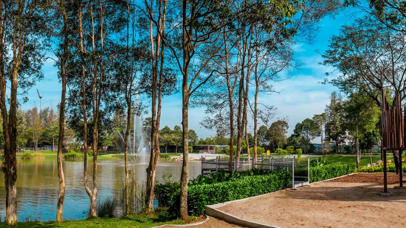
Setia Bayuemas' most visible piece of flood infrastructure is not a drain at all. It is Lake Park, a 10-acre landscaped water feature at the centre of the township. Functionally, a feature like this operates as a detention or retention pond: a body of water sized to absorb a surge in stormwater during heavy rain, then release it gradually so downstream drains are not overwhelmed all at once. DID Malaysia's MSMA manual sets out this exact engineering logic in its chapter on detention ponds, which has become the reference standard for how new Malaysian townships are expected to manage runoff rather than simply pushing it downstream.
The dual-purpose design is deliberate and increasingly common in Malaysian master planning: the same body of water that manages runoff during a storm is a park, a walking loop and a view from surrounding homes on every ordinary day. For residents, that means the flood-management function is mostly invisible: it only does its engineering job during heavy rain, and otherwise reads simply as green space.
Flood-Free Living: What Residents Say
SP Setia's own Setia Bayuemas testimonials feature families who relocated from denser parts of the Klang Valley, such as Subang Jaya and Petaling Jaya, citing safety and green space among their reasons for moving. These are first-party testimonials rather than independently verified reviews, so they are worth treating as one input among several rather than the final word.
The more useful exercise for a serious buyer is to verify conditions directly: visiting the show gallery during or shortly after heavy rain, walking the actual lot and surrounding drains, and asking the sales team for the project's engineering and drainage approval documents rather than relying on a summary. A developer confident in its drainage design should have no difficulty producing that documentation on request.
FAQ
Frequently asked questions
SP Setia states the township has had no flood disruptions since it began welcoming residents, and the area does not appear on Klang City Council's 2025 list of mapped flood-prone neighbourhoods.
Parts of Klang district have recorded flash floods, including in April 2025. However, flood risk in Klang is localised to specific low-lying neighbourhoods rather than affecting the whole district uniformly, and reports of "Klang Valley" floods often refer to other parts of the wider conurbation, such as Petaling Jaya or Kajang, rather than Klang town itself.
Klang Royal City Council has committed RM182 million between 2025 and 2030 to its Klang Sustainable Stormwater Plan (KLASS), covering both physical drainage works and vulnerability mapping, following 54 projects worth RM38 million already completed.
A detention or retention pond is a body of water engineered to absorb a surge of stormwater during heavy rain and release it gradually, so downstream drains are not overwhelmed all at once. This is the standard set out in Malaysia's DID/MSMA stormwater manual. Setia Bayuemas' 10-acre Lake Park follows this same principle while functioning as a everyday park for residents.
References
- Department of Irrigation and Drainage Malaysia (DID) (2012) Urban Stormwater Management Manual for Malaysia (MSMA), 2nd edn. Kuala Lumpur: DID Malaysia. Accessed: 28 September 2026.https://did.sarawak.gov.my/web/attachment/show/?docid=TGpTNUJRMmFzRXhkb0NUN0xuZEEvdz09Ojr0qQ0hRh0QPdV4ie9S7VGA (opens in a new tab)
- Malay Mail (2025) 'Flash floods hit Selangor after relentless downpour, affecting Petaling, Klang, Hulu Langat and Shah Alam', Malay Mail, 11 April. Accessed: 28 September 2026.https://www.malaymail.com/news/malaysia/2025/04/11/flash-floods-hit-selangor-after-relentless-downpour-affecting-petaling-klang-hulu-langat-and-shah-alam-video/172672 (opens in a new tab)
- National Disaster Management Agency (NADMA) (2025) 'RM182mil set aside for flood mitigation in Klang', NADMA Portal, 4 March. Accessed: 28 September 2026.https://www.nadma.gov.my/bi/media-en/news/3012-rm182mil-set-aside-for-flood-mitigation-in-klang (opens in a new tab)
- SP Setia Homes (2026) Setia Bayuemas [Website]. Accessed: 28 September 2026.https://spsetiahomes.com/setia-bayuemas (opens in a new tab)
- The Star (2026) 'Flash floods hit parts of Klang Valley', The Star, 26 September. Accessed: 28 September 2026.https://www.thestar.com.my/news/nation/2026/09/26/flash-floods-hit-parts-of-klang-valley (opens in a new tab)
 WhatsApp Us